For any questions, concerns, multiple item orders and/or page reproductions, please email libraryservices@freepress.mb.ca.

Close

The Free Press News

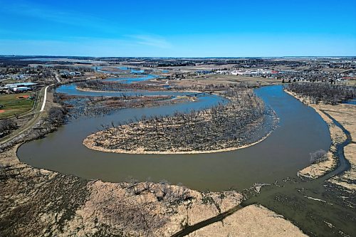
Water from the swollen Assiniboine River floods low-lying areas bordering the riverbanks in Brandon on Tuesday. As of Thursday morning, the province's interactive online flood map said the river had already peaked at most points from the Shellmouth Dam to Brandon, except near Virden where the peak was expected either Wednesday or Thursday. The river as measured at 18th Street in Brandon was at 1175.86 feet above sea level on Thursday. (Tim Smith/The Brandon Sun)


Photo description:

Water from the swollen Assiniboine River floods low-lying areas bordering the riverbanks in Brandon on Tuesday. As of Thursday morning, the province's interactive online flood map said the river had already peaked at most points from the Shellmouth Dam to Brandon, except near Virden where the peak was expected either Wednesday or Thursday. The river as measured at 18th Street in Brandon was at 1175.86 feet above sea level on Thursday. (Tim Smith/The Brandon Sun)

You Might Also Like View More Photos